LiDAR for Smarter Dam & Reservoir Monitoring

LiDAR for Smarter Dam & Reservoir Monitoring
LiDAR (Light Detection and Ranging) is a remote sensing technology that uses laser pulses to measure distance and capture detailed spatial information. It can create accurate three-dimensional representations of terrain, structures, and surrounding areas. For dams and reservoirs, this technology can provide a detailed digital view of the physical environment. LiDAR can support surveying, mapping, documentation, terrain assessment, and infrastructure monitoring. It is particularly useful for large sites and areas where conventional surveying can require significant field effort. By converting physical surroundings into digital spatial data, LiDAR can support better visualization and engineering analysis.
Understanding LiDAR Technology
LiDAR works by sending laser pulses toward a surface and measuring the time taken for the reflected signal to return. The collected measurements are processed to create spatial datasets representing the shape and elevation of the surveyed environment. LiDAR systems can be deployed using drones, aerial platforms, vehicles, or ground-based equipment depending on the survey requirement.
- Captures detailed spatial measurements
- Generates high-density 3D point clouds
- Provides elevation and terrain information
- Supports large-area surveying
- Helps capture difficult-to-access locations
- Creates digital datasets for further processing
3D Mapping of Dam Structures
LiDAR can capture detailed three-dimensional information about dam structures, embankments, slopes, spillways, and surrounding terrain. The resulting point-cloud data can be processed into 3D models that provide a digital representation of the surveyed site.
Mapping Applications
- Dam crest and structural surface mapping
- Spillway and surrounding area mapping
- Embankment and slope mapping
- Reservoir boundary and terrain mapping
- Topographic and elevation data collection
- Detailed site documentation These outputs can support engineering teams in understanding the physical characteristics of complex dam and reservoir environments.
Digital Elevation Models
LiDAR survey data can be processed into digital elevation models and detailed terrain representations. These models provide information about elevation, surface shape, and terrain characteristics across the surveyed area.
Digital Outputs
Digital elevation models can support engineering surveys, terrain assessment, site documentation, spatial analysis, and visualization. They can also provide a consistent digital reference for comparing surveyed areas and understanding changes in surface conditions.
Monitoring Terrain Changes
Repeated LiDAR surveys can generate datasets from different time periods that can be compared to understand measurable changes in terrain and surface features. This approach can support periodic surveying and digital documentation of dams, reservoirs, embankments, and surrounding areas.
Monitoring Applications
- Comparing terrain models from different survey periods
- Identifying measurable changes in slopes and surface features
- Documenting changes around reservoir areas
- Supporting periodic infrastructure surveys
- Maintaining digital records of surveyed locations LiDAR-based comparison can complement conventional inspection and surveying activities by providing detailed spatial information.
Benefits for Water Infrastructure
LiDAR provides a technology-driven approach for capturing detailed spatial information across large or difficult-to-access water infrastructure sites.
- Detailed 3D spatial information
- Efficient coverage of large survey areas
- Digital terrain and elevation data
- Reduced dependence on extensive manual measurements
- Better visualization of complex infrastructure
- Useful datasets for engineering documentation These capabilities can help water-resource teams organize spatial information and develop a clearer digital understanding of infrastructure and surrounding terrain.
From Survey Data to Digital Insights
LiDAR surveys can generate large volumes of spatial data that can be processed into 3D point clouds, elevation models, terrain models, and visual representations.
Connected Monitoring
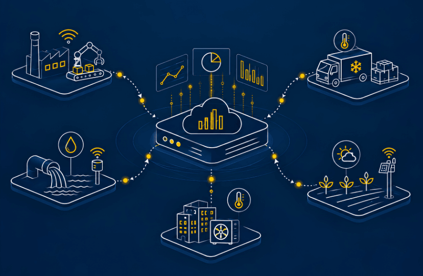
When LiDAR is integrated with IoT sensors, telemetry, GIS, cloud platforms, and other monitoring technologies, spatial and field data can be brought together.
Digital Infrastructure
This connected approach can create a broader digital monitoring environment where physical infrastructure and field information can be viewed through a common digital workflow. It can support visualization, documentation, comparison, and analysis of water-resource infrastructure data.
Enthutech AIoT and Smart Water Infrastructure
Enthutech AIoT solutions are focuses on technology-driven solutions for water and infrastructure monitoring. The approach combines field sensing, IoT, telemetry, and digital platforms to support connected monitoring workflows. For dams and reservoirs, LiDAR can provide detailed spatial information about structures, terrain, slopes, and surrounding areas.
- Supports digital mapping of water infrastructure
- Connects spatial information with monitoring data
- Helps create detailed digital representations
- Supports technology-driven infrastructure assessment By combining LiDAR with other monitoring technologies, Enthu Tech aims to support smarter, connected, and data-driven approaches to water-resource infrastructure.
Keep Exploring Our Blog Collection
© 2026, Enthu Technology Solutions India Pvt. Ltd. All Rights Reserved.